Mount Wasilewski
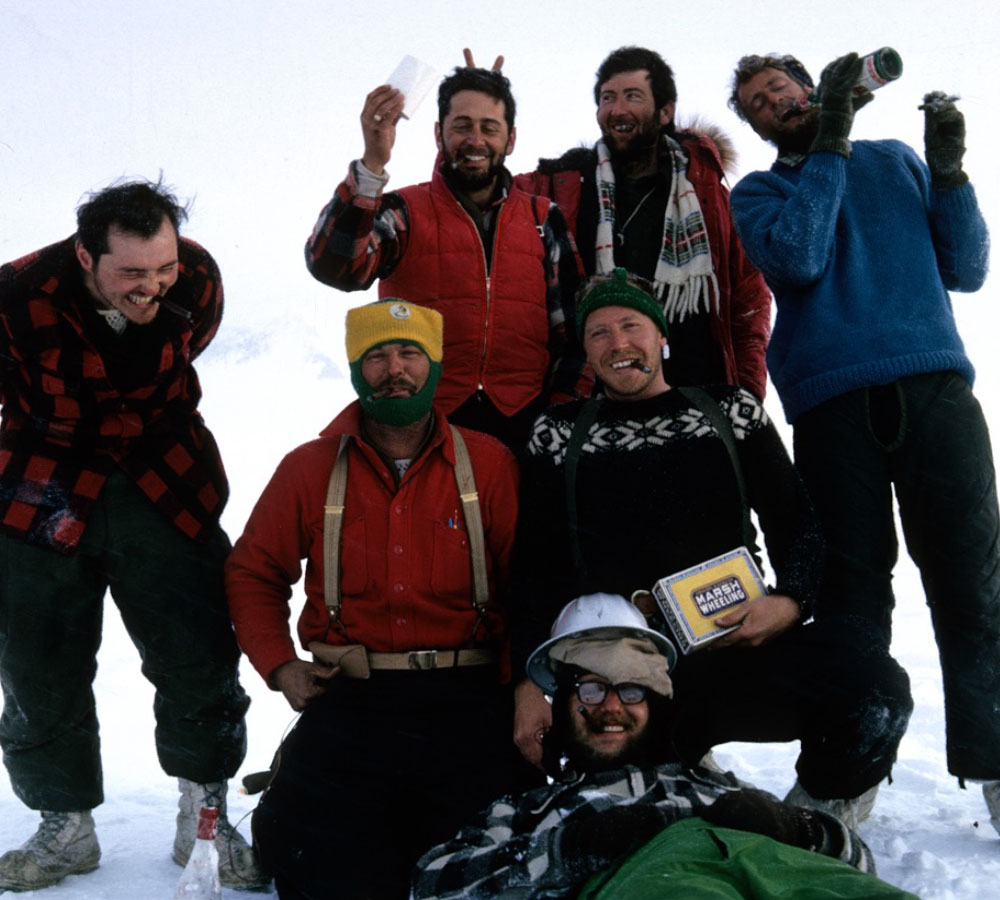
This team has a bond even though the team is no longer intact. An international group from the USA, Australia and New Zealand.
The expedition
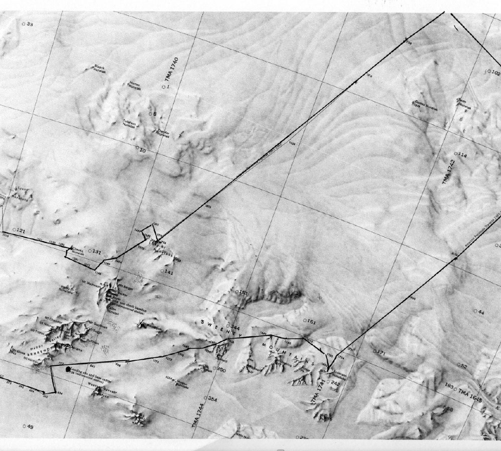
The EN expedition was developed as a consequence of the geologic outcrop identified during the APT traverse. The APT traverse track is indicated and the location of the EN base station and mount Wasilewski are indicated by the red dots.
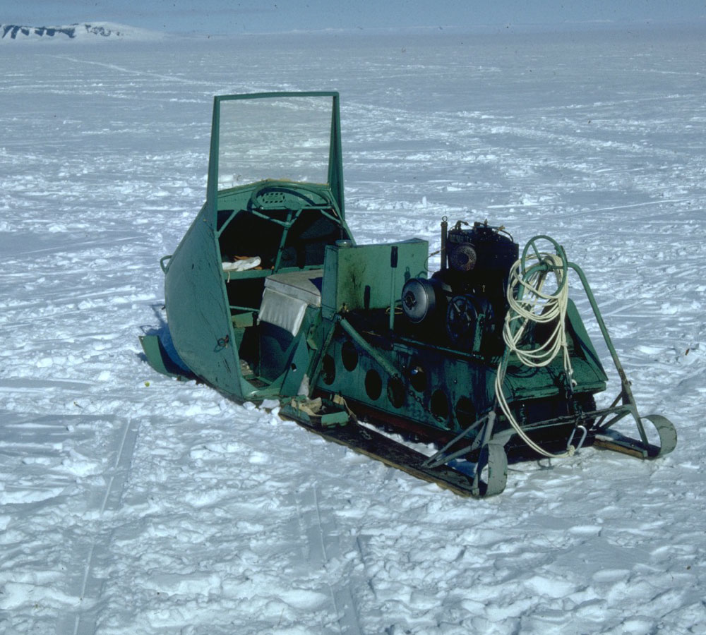
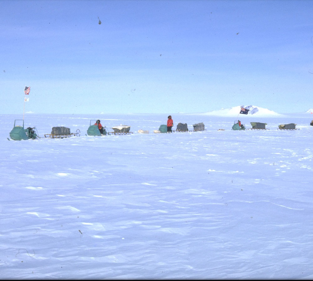
Snow Mobile
The mode of transportation turned out to be more personal, a snowmobile for each of us.
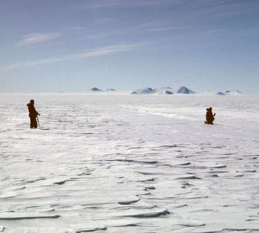
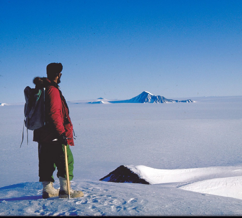
Surveying the terrain
We were always proximate to mountains and therefor hidden terrain that might provide conditions for crevasse development was always a possibility.
Into the unknown
During the early phase of our exploration we travelled from base camp to what we called happy valley with no sign of crevasse danger. About a moth later we travelled the same path with notable evidence that the bridges on numerous crevasses had collapsed.
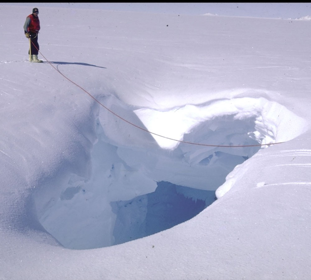
Crevasse!
This gaping crevasse presented no danger but revealed how extreme a crevasse can be if travelling in a white out for example.

A modest camp
Lorem ipsum dolor sit amet, consectetuer adipiscing elit. Aenean commodo ligula eget dolor. Aenean massa. Nulla consequat massa quis enim. Sociis natoque penatibus et magnis dis parturient montes, nascetur ridiculus lorem mus.
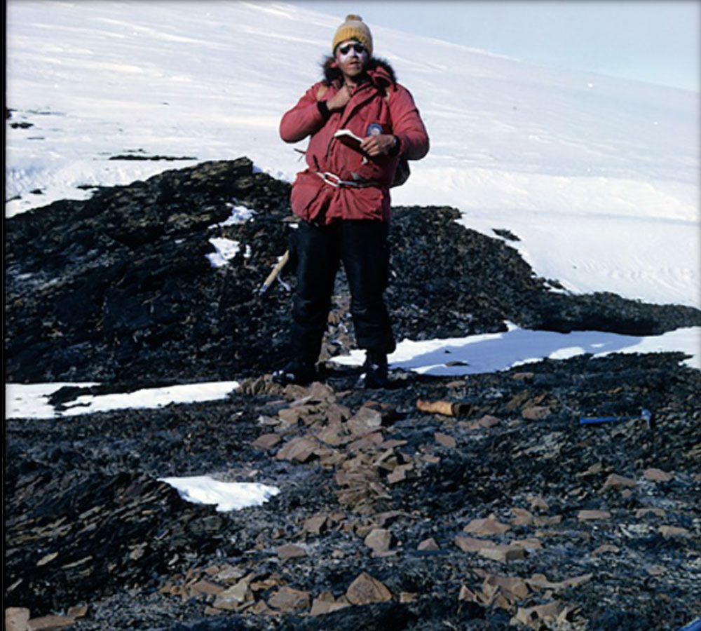
Collecting samples
The EN expedition visited rock sites discovered by the APT traverse. The rocks were identified, collected to be returned for analysis. Sedimentary, Igneous and metamorphic rocks were found includings rocks with fossil shells.
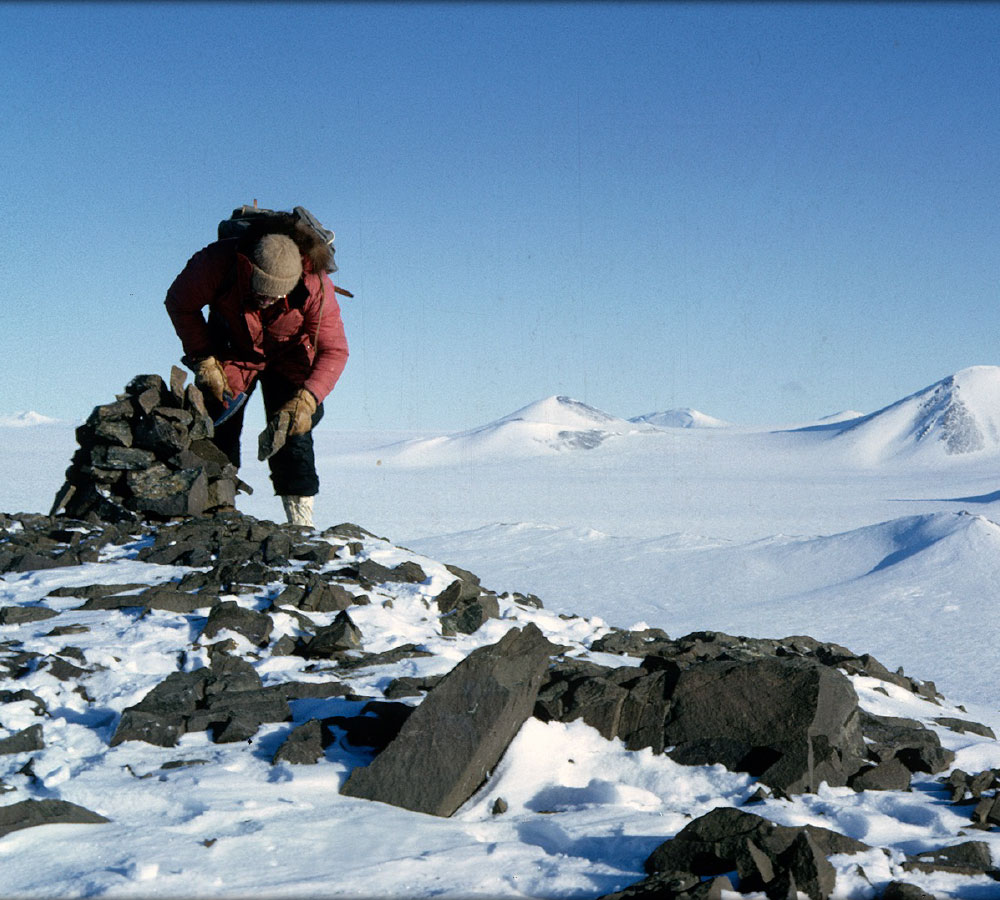
Geologic signposts
Rock piles were located at strategic rock outcrops to be used in the survey and geo-location of the rock sites throughout the EN expedition reach
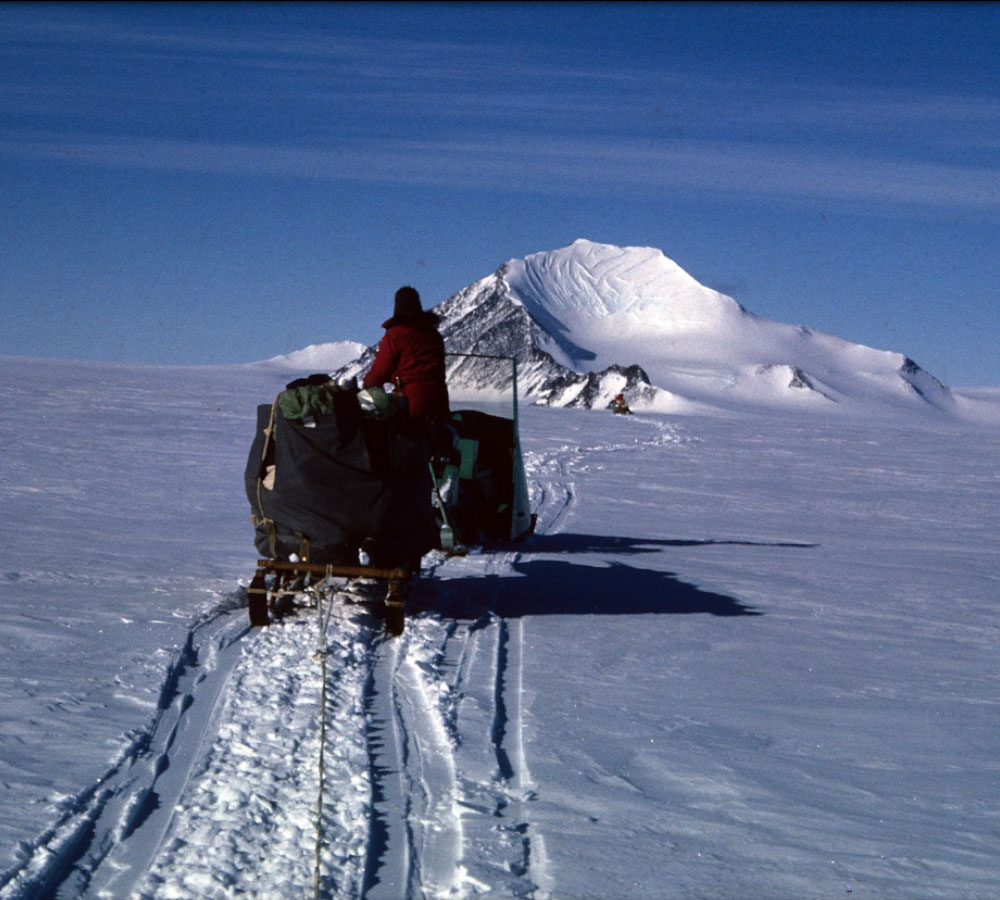
To the mountain
Mobile team leaves base camp to visit mount Wasilewski.
The glacial cirque (cutout) is visible
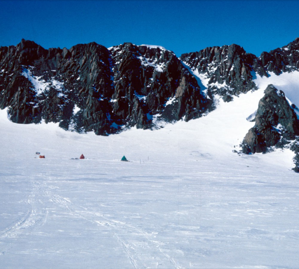
Base of the Mountain
Mobile camp site at the base of Mount Wasilewski
Mount Wasilewski
Lorem ipsum dolor sit amet, consectetuer adipiscing elit. Aenean commodo ligula eget dolor. Aenean massa. Nulla consequat massa quis enim. Sociis natoque penatibus et magnis dis parturient montes, nascetur ridiculus lorem mus.
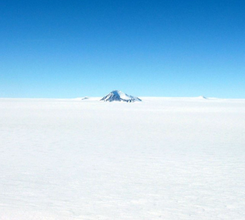
Mt Wasilewski Data
The photo above showing remote mountain peaks protruding through the Antarctic ice sheet captures the utter isolation of the frozen continent. The prominent peak, in the mid-ground, is Mount Wasilewski (5,299 ft or 1,615 m), standing silent among the vast, wide open white. I came across this poignant scene while deploying and servicing GPSand seismic stations near the base of the Antarctic Peninsula, not far from Union Glacier. The ice sheet in the vicinity of Mt. Wasilewski is approximately 4,000 ft (1,219 m) thick. Mt. Wasilewski is named for Dr. Peter J. Wasilewski, an astrophysicist at NASA and a renowned meteorite hunter. Photo taken from the ridgeline of Mount Suggs in November 2011.
•Mount Wasilewski, Antarctica Coordinates: -75.183333, -71.4